The faulted alluvial fans near Badwater in Death Valley are amongst the most visited and classic landforms in the U.S. New mapping and dating of these landforms, presented in this open-access study by Kurt Frankel and colleagues, help to determine the timing of past earthquakes and how tectonic deformation is distributed across the western U.S.
This in turn provides important data for seismic hazard mitigation and for understanding how the great landscapes of the western U.S. have evolved over recent geologic time.
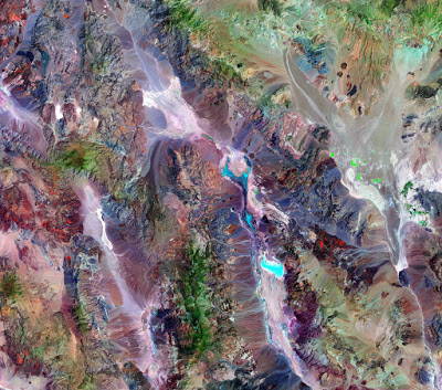
Death Valley constitutes one of the most dramatic landscapes in North America, and it is famous for its faulted mountain fronts, spectacular alluvial fans, and extensive saline playa. Moreover, the valley is the type example of a pull-apart basin, which is controlled by the northern Death Valley-Fish Lake Valley fault zone, the Black Mountains fault zone, and the southern Death Valley fault zone.
These three fault zones make up the Holocene fault zones of the Death Valley fault system. This Death Valley pull-apart often provides an analog for the evolution, including stress transfer and depositional systems, in other tectonically active transtensional regimes, such as the Dead Sea, East Africa, and Alpine fault of New Zealand.
Reference:
Kurt L. Frankel, Lewis A. Owen, James F. Dolan, Jeffrey R. Knott, Zachery M. Lifton, Robert C. Finkel, Thad Wasklewicz. Timing and rates of Holocene normal faulting along the Black Mountains fault zone, Death Valley, USA. Lithosphere, 2015; L464.1 DOI: 10.1130/L464.1
Note: The above post is reprinted from materials provided by Geological Society of America.


