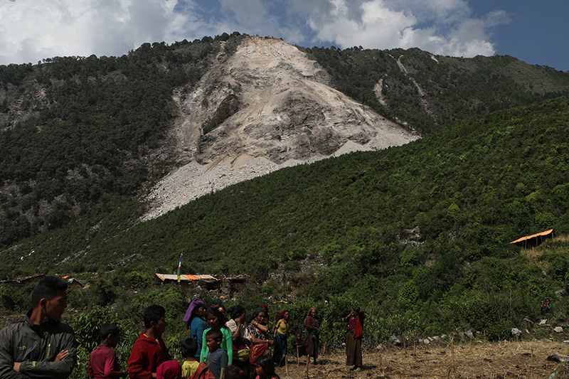
A new report from the U.S. Geological Survey provides critical landslide-hazard expertise to Nepalese agencies and villages affected by the April 25, magnitude 7.8 earthquake that shook much of central Nepal. The earthquake and its aftershocks triggered thousands of landslides in the steep topography of Nepal, and caused nearly 8,900 fatalities. Hundreds of those deaths were due to landslides, which also blocked vital road and trail lifeline routes to affected villages.
Landslides caused by the earthquakes continue to pose both immediate and long-term hazards to villages and infrastructure within the affected region. Several landslides blocked rivers, creating temporary dams, which were a major concern for villages located downstream. The report provides a rapid assessment of landslide hazards for use by Nepalese agencies during this current monsoon season.
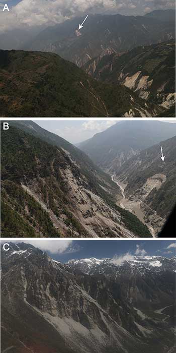
With support from the U.S. Agency for International Development’s Office of U.S. Foreign Disaster Assistance, and in collaboration with earthquake-hazard organizations from both the United States and Nepal, the USGS responded to this landslide crisis by providing expertise to Nepalese agencies and affected villages. In addition to collaborating with an international group of remote-sensing scientists to document the extent and spatial distribution of landsliding in the first few weeks following the earthquake, the USGS conducted in-country landslide hazard assessments for 10 days in May and June. Much of the information obtained by the USGS in Nepal was conveyed directly to affected villages and government agencies as opportunities arose. Upon return to the United States, data organization, interpretation and synthesis immediately began in order to publish a final report.
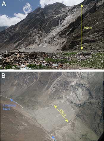
This new report provides a detailed account of the assessments performed in May and June, with a particular focus on valley-blocking landslides because they have the potential to pose considerable hazard to many villages in Nepal. The results include an overview of the extent of landsliding, a presentation of 74 valley-blocking landslides identified during the work, and a description of helicopter-based video resources that provide over 11 hours of high resolution footage of approximately 1,000 km (621 miles) of river valleys and surrounding areas affected by the earthquakes. A description of site-specific landslide-hazard assessments conducted while in Nepal and detailed descriptions of five noteworthy case studies are also included. The report ends with an assessment of the expectation for additional landslide hazards in the summer monsoon season following the earthquakes.
Video
Reference:
Assessment of existing and potential landslide hazards resulting from the April 25, 2015 Gorkha, Nepal earthquake sequence. http://pubs.er.usgs.gov/publication/ofr20151142
Note: The above post is reprinted from materials provided by U.S. Geological Survey.


