University and government scientists are embarking on a collaborative research expedition to improve volcanic eruption forecasting by learning more about how a deep-underground feeder system creates and supplies magma to Mount St. Helens.
They hope the research will produce science that will lead to better understanding of eruptions, which in turn could lead to greater public safety.
The Imaging Magma Under St. Helens project involves three distinct components: active-source seismic monitoring, passive-source seismic monitoring and magnetotelluric monitoring, using fluctuations in Earth’s electromagnetic field to produce images of structures beneath the surface.
Researchers are beginning passive-source and magnetotelluric monitoring, while active-source monitoring – measuring seismic waves generated by underground detonations – will be conducted later.
Passive-source monitoring involves burying seismometers at 70 different sites throughout a 60-by-60-mile area centered on Mount St. Helens in southwestern Washington. The seismometers will record data from a variety of seismic events.
“We will record local earthquakes, as well as distant earthquakes. Patterns in the earthquake signatures will reveal in greater detail the geological structures beneath St. Helens,” said John Vidale, director of the University of Washington-based Pacific Northwest Seismic Network.
Magnetotelluric monitoring will be done at 150 sites spread over an area running 125 miles north to south and 110 miles east to west, which includes both Mount Rainier and Mount Adams. Most of the sites will only be used for a day, with instruments recording electric and magnetic field signals that will produce images of subsurface structures.
Besides the UW, collaborating institutions are Oregon State University, Lamont-Doherty Earth Observatory at Columbia University, Rice University, Columbia University, the U.S. Geological Survey and ETH-Zurich in Switzerland. The work is being funded by the National Science Foundation.
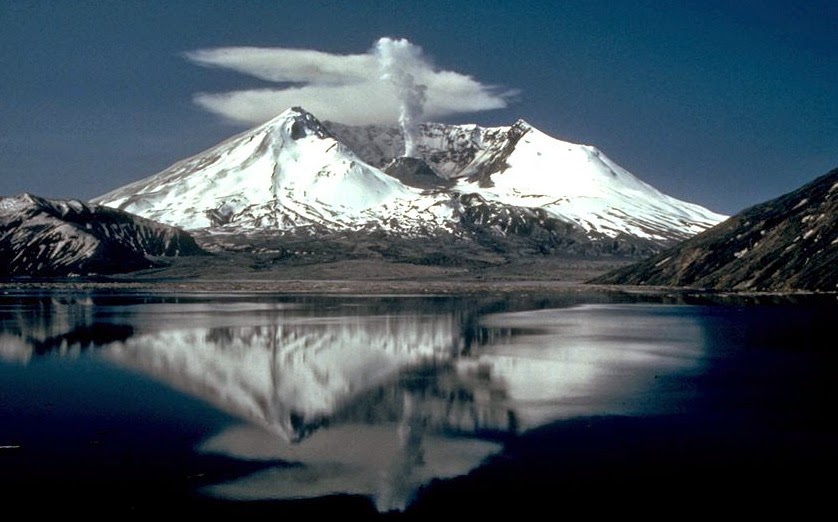
Mount St. Helens has been the most active volcano in the Cascade Range during the last 2,000 years and has erupted twice in the last 35 years. It also is more accessible than most volcanoes for people and equipment, making it a prime target for scientists trying to better understand how volcanoes get their supply of magma.
The magma that eventually comes to the surface probably originates 60 to 70 miles deep beneath St. Helens, at the interface between the Juan de Fuca and North American tectonic plates. The plates first come into contact off the Pacific Northwest coast, where the Juan de Fuca plate subducts beneath the North American plate and reaches great depth under the Cascades. As the magma works its way upward, it likely accumulates as a mass several miles beneath the surface.
As the molten rock works its way toward the surface, it is possible that it gathers in a large chamber a few miles beneath the surface. The path from great depth to this chamber is almost completely unknown and is a main subject of the study.
The project is expected to conclude in the summer of 2016.
Note : The above story is based on materials provided by University of Washington


